Sand Ridge W6/NS-155 Activation
- Dan Koellen AI6XG

- Jan 12, 2020
- 4 min read
Updated: Jul 12, 2021

Operating Position Looking South From Sand Ridge
Summit Trip Summary
Distance: ~ 6.5 mi one way
Transport: Hiking
Elevation Gain: 1200 feet net
Time: ~ 3 hours one way
Route: Via Pacific Crest Trail and Hole In the Ground Trail
Access: I80 exit 176 Castle Peak Road
Parking: On Castle Peak Road or at Donner Summit Sno-Park
Activation Summary
Rig: KX2, TH-D72A
Bands/Modes: 20 mtr - CW, 40 mtr - CW, 2 mtr FM
Antenna: zip cord 20 mtr dipole, 2 mtr duckie
Antenna Support: Trees
Cell Service: Good (Verizon)
RF Noise: Quiet
Click on this link for GPX file
This summit has intrigued me for a while since it had not been activated for a couple years and, unlike other peaks I have worked, there is no path to the summit. It was time to bushwhack to a summit! I have had a few years of experience hiking in the back country with a pretty good sense of direction, have maps downloaded on my phone and paper map back up. It is easy to get lost so make sure you have some experience under your belt before doing much bushwhacking. It is easy to get disoriented, there have been a few times off trails that I did not believe the direction on my phone until I verified by looking at the direction of shadows; it is good to have non tech back up. I did a few reconnaissance trips prior to my activation trip and I will outline two ways to the summit. One with some bushwhacking and the other with more bushwhacking.
Both ways start from the Pacific Crest Trail (PCT) turnoff (39.3699, -120.3670) onto Sand Ridge Lake trail towards Hole In the Ground Trail (HIGT). The turnoff is about 0.2 miles north of Peter Grubb Hut. To get to this point I either park on Castle Peak Road or at the Donner Summit Sno-Park from Exit 176 off of I-80. The quickest way is to go up Castle Peak road or you can take the longer but less steep PCT from the Sno-Park. A high clearance vehicle will be able to go up Castle Peak road to the parking area near Castle Pass. I don't have such a vehicle so I hiked about 45 minutes to the parking area. Just to the left of the parking area is a trail that leads to the PCT and Castle Pass. Proceed past Castle Pass on the PCT down to Round Valley, past Peter Grubb hut to Sand Ridge Lake trail turnoff that is just after you cross Lower Castle Creek.
Proceed down Sand Ridge Lake trail for about 0.7 miles and it will end at the HIGT. Turn right onto HIGT but be sure to note where the turn off is so you can find it on your way back. The HIGT is a very nice trail going past large boulders, a few meadows and through forest. It is shared with mountain bikers so beware of approaching bikes. At the turnoff (39.37634, -120.38535) to Sand Ridge Lake the two ways diverge. There is a trail and a small sign at the turnoff.
More Bushwhacking (Trek 1)
Refer to the 'PCT to Sand Ridge via Sand Ridge Lake' map
To go this route, take the trail to Sand Ridge Lake, a very beautiful lake and great place to take a break. WB0USI outlined a back country way to Sand Ridge via Sand Ridge Lake on his post on SOTA summit information for Sand Ridge. He provided a good description of his trek from Sand Ridge Lake to the summit. Despite nature changing things I was able to follow his directions to find the Forest Service (FS) road. Once you are on the FS road proceed north (right) after marking your access point, you will glad you did on your way back (as I found out). I followed the road per WB0USI instructions until the end of the road (39.37117, -120.39887). At that point I built a small cairn and bushwhacked my way up the slope to the summit. I recommend making some marks on the way up to the summit because coming back down it is easy to lose direction and miss the FS road. On this trek I returned the way I came as best as I could. I tracked myself as denoted in the 'PCT to Sand Ridge via Sand Ridge Lake' map above. I had a bit of a problem finding my turnoff off of the FS road as you can see in the track. But if you choose to go this way, the map will give you a good idea of how to proceed. The back country trek south of Sand Ridge Lake is beautiful and worth a try.
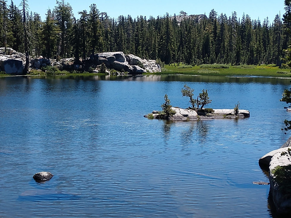
Sand Ridge Lake
Some Bushwhacking (Trek 2)
Refer to 'PCT to Sand Ridge via Hole In the Ground Trail' map
On my second reconnaissance trek I found another way to the FS road by taking HIGT past the Sand Ridge Lake turnoff. Continue past the turnoff for about another 1 mile until you arrive at (39.37352, -120.39833). At this point you should see some OHV tracks that go up towards Sand Ridge summit, this is the way up to the Forest Service road. I built a small cairn on HIGT and ascended towards the FS road following a slight clearing. After about 10 minutes you get to the FS road (39.37205, -120.39728), mark the spot and turn right to the end of the road (39.37117, -120.39887) . At that point I built a small cairn and bushwhacked my way up the slope to the summit. I recommend making some marks on the way up to the summit because coming back down it is easy to lose direction and miss the FS road.
This is the way that I decided to take when I activated Sand Ridge. It is an easier trek especially when your backpack is packed with radio gear.
On the Summit
The summit is narrow and long with many wind gnarled trees. Very few people come up to this summit so enjoy the quiet solitude. Verizon cell phone coverage is adequate to spot and the summit is RF quiet. There are small trees to hold up a mast and tall trees to throw a line through. I set my mast up against a small tree and spread the ends of my dipole out to branches of tall trees. I was able to work into the Sacramento area on 146.520 simplex with my HT.
The summit takes a bit of work to get to but it is definitely worth the effort.

Looking Southwest at Castle Peak from Sand Ridge Summit


The Apple Watch Ultra provides more information about link its individual wearer and their surroundings than practically any other watch in history. And it delivers that information in a sustainable and engaging way, all the while providing real-time, lived-in feedback in a link way that a bulky smartphone stashed in link a pocket just can't do.
Meylan's watches were the first real pocket watches that I really looked at in detail and after studying them I noticed many of them don't have any logos on the dial. Back link in the 19th and even 20th century, on some of Meylan's greatest watches, there was no logo. I remember wondering why, Edouard link said. "Suddenly, I realized that it used to be that when you went to link a watchmaker, you knew what you got – there was no need for a name. I realized I wanted Moser to be the essence of that experience."