Castle Peak W6/SN-038 Activation
- Dan Koellen AI6XG
- Jan 12, 2020
- 3 min read
Updated: Dec 13, 2020

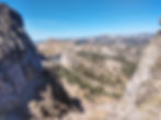
Operating Position on Castle Peak Looking Southwest
Summit Trip Summary
Distance: ~ 3.5 mi one way
Transport: Hiking
Elevation Gain: 1900 feet net
Time: ~ 2 hours one way
Route: Via Castle Peak Road to Pacific Crest Trail
Access: I-80 exit 176 Castle Peak Road
Parking: On Castle Peak Road or at Donner Summit Sno-Park
Activation Summary
Rig: KX2, TH-D72A, MTR3b LCD
Bands/Modes: 20 mtr - CW, 40 mtr - CW, 2 mtr FM
Antenna: zip cord 20 mtr dipole, 2 mtr duckie, Trapped 20/30/40 EFHW
Antenna Support: crevice
Cell Service: Good (Verizon)
RF Noise: Quiet
The climb to this summit is steep with a lot of loose rock, make sure you have poles and good hiking boots. Especially for the trip back down. The approach to Castle Peak from Castle Pass and the Pacific Crest Trail is the most popular route. You will likely have company on your hike to the summit. There is another approach to the south face from Warren Lake trail, turning off at Frog Lake Cliff. I have attempted this a few times but was never successful in getting to the summit.
To start the hike to Castle Pass and on to Castle Peak, either park on Castle Peak Road or at the Donner Summit Sno-Park from Exit 176 off of I-80. The quickest way is to go up Castle Peak road or you can take the longer but less steep PCT from the Sno-Park. A high clearance vehicle will be able to go up Castle Peak road to the parking area near Castle Pass. I don't have such a vehicle so I hiked about 45 minutes to the parking area. Just to the left of the parking area is a trail that leads to the PCT and Castle Pass.
At Castle Pass you can see the trail leading to Castle Peak heading east. Just follow the trail as it finds its way to the summit, it will take you about an hour and will be steep in places. The instructions from WB0USI on the SOTA summit information site are good and easily followed. As he said, you will encounter a series of switchbacks and climbs. As you are approaching the east face you will run into the trail that runs from Castle Peak to Basin Peak. Turn towards Castle Peak and continue to ascend. There are a number of trails near the top but they all tend to lead you to the summit. Even if you took a different turn lower down on the slope and headed more west, the trails will still take you towards the summit. I have taken both routes without any issue.
There are three turrets on Castle Peak, giving the summit its name. The south most turret is the actual summit, the activation zone is that turret. There is a lot of rock and some small trees near the summit. I used a crevice for my mast for my trapped EFHW, the feed point attached to one of my trekking poles. I set up near the northwest side of the summit and off to the side near the edge. Castle Peak is very popular so expect some company though most people don't venture to the summit turret. The Verizon cell connection is very good, you can easily spot and keep tabs on other spotters. The site is RF quiet as well. I was able to work into Sacramento area on 146.520 FM simplex with just my HT.

Going back down can be treacherous with the steepness and the abundant small round rock. Be careful on the way down. If I have time I prefer to hike over to Basin Peak and take the trail on the north side of Basin Peak that eventually takes you back to the PCT. It adds more distance and time but a nice enjoyable hike.


